In the center of Siena, Italy, a cathedral has stood for nearly 800 years. A black-and-white layer cake of heavy stone, fine-cut statuary, and rich mosaics, the imposing structure—now visited by more than a million tourists each year—would seem to be a permanent fixture of the city’s past, present, and future. Most people call it, simply, “the cathedral.” But Stefano Campana, a 53-year-old archaeologist at the University of Siena, calls it something else: “the church that is visible now.”
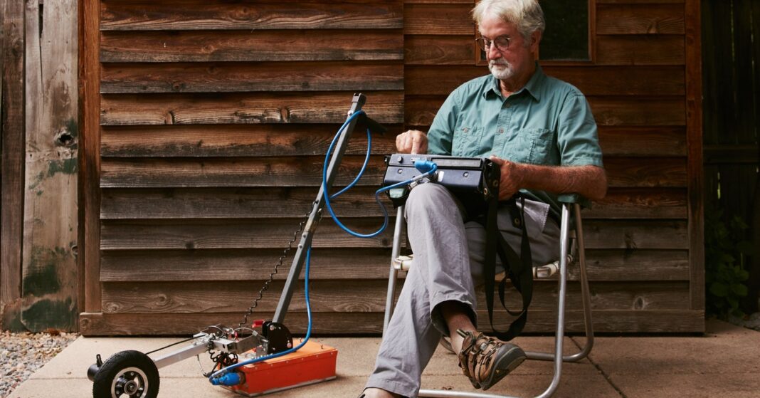
Campana has seen his fair share of excavations, along with the dust and sunburns that accompany them. But archaeology, for him, is not always about digging up the past; it also means peering down into it using an array of sensitive electromagnetic equipment. One device Campana uses is ground-penetrating radar, which works by transmitting high-frequency waves into the earth to reveal “anomalies”—subsurface features that are potentially architectural—in the signals that bounce back.
In early 2020, when Covid lockdowns emptied Italian tourist sites of their crowds, Campana and his collaborators received permission to survey the Siena cathedral’s interior. Using instruments originally developed for studying glaciers, mines, and oil fields, they spent days scanning marble floors and intricate mosaics, on the hunt for walls and foundations in the deep. With the selfie-stick brigade gone, Campana and his crew were able to find evidence of earlier structures, including, potentially, a mysterious church constructed there nearly 1,200 years ago, lurking like a shadow in the radar data.
After seeing how much they achieved during Italy’s lockdown, Campana and his collaborators got to thinking about what else might be possible with the technology. Ground-penetrating radar waves travel at a fraction of the speed of light, so the entire process—transmission, reflection, recording—takes nanoseconds. With these new tools, archaeology is no longer a stationary activity, limited to one site; even while zipping by at highway speed, field surveyors can produce an accurate snapshot of what’s beneath centuries of cobblestone and brick, chewing gum and litter.
“We thought, why not scan everything?” Campana recalled. “Why not scan all the squares, all the roads, all the courtyards in Siena?” Unlike the cathedral and its shadow church, these everyday sites are not protected, which means they are threatened by modern construction and development. In the public imagination, they are what Campana calls “emptyscapes”—places wrongly considered insignificant to the human story. He wanted to change that. Campana partnered with Geostudi Astier, a geophysical surveying firm in Livorno, to launch an initiative called Sotto Siena (“Under Siena”). True to its acronym, SoS, the project aims to create a complete archaeological record of Siena before more of the city’s deep history is destroyed.
Last spring, I traveled to Siena in the midst of a heat wave to see SoS in action. Campana and I met in the central Piazza del Campo to fortify ourselves with espresso before walking toward a park in a more modern part of the city. To see Siena through Campana’s eyes is to exist in overlapping worlds. As we strode up stairs and down alleyways, past restaurants and through piazzas, he explained that radar can reveal foundation walls beneath busy streets and back gardens. Corner shops can hide Etruscan ruins under their cash registers. Even temporary structures, lost long ago to war, fire, and history, can be rediscovered using radar. Some of the first SoS scans, he said, found evidence of small pavilions in the Piazza del Campo, likely set up for public fairs and festivals as far back as the 15th century.
When we reached our destination, a white cargo van was waiting for us. Campana introduced me to Giulia Penno and Filippo Barsuglia, geophysicists from Geostudi Astier, who were unloading equipment for a survey that evening. Their city-scanning setup consisted of an electric utility vehicle the size of a golf cart and an array of sealed boxes, studded with ports and wires. As Barsuglia carefully backed the utility vehicle out of the van, Penno gave me an overview of the gear. The boxes contained several heavy racks of radar equipment, which we’d tow a few inches off the ground. A Wi-Fi antenna would relay the data to a hardened laptop. We couldn’t count on clear satellite signals in Siena’s twisty streets, so the system was equipped with inertial navigation, which uses gyroscopes and accelerometers to track every stop and turn. Barsuglia claimed it was the only such system in all of Italy, outside the military.


