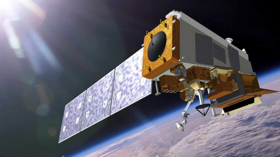
The third in a series of five polar-orbiting satellites developed by NASA and the National Oceanic and Atmospheric Administration (NOAA) to study Earth’s weather and environment will launch on Tuesday (Nov. 1).
Riding atop an Atlas V rocket from Vandenberg Space Force Base in California, the JPSS-2 satellite, part of the Joint Polar Satellite System, will blast off to provide meteorologists and climatologists important data to help predict extreme weather events and to better understand how these events affect our planet.
JPSS-2 will join the Suomi National Polar-orbiting Partnership (Suomi NPP), which launched in 2011, and NOAA-20, which launched in 2017 as JPSS-1, in polar orbit around Earth. JPSS-2 will be renamed NOAA-21 once it is in orbit and conducting scientific operations. Two further launches, JPSS-3 and JPSS-4, are planned for 2027 and 2032, respectively.
Related: Earth tells us to ‘GO’ in weird cloud message seen from space (photo)
In their polar orbits, the satellites circle the Earth 14 times per day. From this vantage point, “JPSS-2 will observe every place on Earth at least twice a day as the satellite orbits the Earth from pole to pole,” Tim Walsh, director of NOAA’s JPSS program, said during a news conference held on Oct. 4. “To predict weather, we really need to be able to observe Earth’s atmosphere from this global perspective.”
To accomplish its mission, JPSS-2 will carry five key instruments into orbit, most of which are also on Suomi NPP and NOAA-20.
Two of these instruments, the Advanced Technology Microwave Sounder (ATMS) and the Cross-Track Infrared Sounder (CrIS), will monitor atmospheric temperature and moisture content, “giving weather forecasters a global 3D picture of … the most fundamental information required by forecast models,” Walsh said.
The two instruments will complement each other. CrIS is limited in how far it can see into clouds because water vapor absorbs infrared light, but ATMS’ microwave instrument can penetrate those clouds, allowing the instrument to see into the hearts of storms.
Another instrument is called Libera, which will play the same role that the less advanced Clouds and the Earth’s Radiant Energy System (CERES) instrument does on Suomi NPP and NOAA-20. These instruments study the energy balance of Earth’s surface and atmosphere, or how much energy is absorbed by Earth’s surface and atmosphere versus how much is emitted back into space, and how this affects temperatures on Earth.
The Ozone Mapping and Profiler Suite (OMPS) will observe the ozone layer, looking for holes and how the concentration of ozone and other aerosols varies globally.
Finally, the Visual Infrared Imaging Radiometer Suite (VIIRS) is “essentially the eyes of the satellite,” Walsh said. VIIRS will capture imagery of Earth’s surface, oceans and atmosphere in visible and infrared light, revealing how much snow and ice covers the planet, how much of the planet is covered by clouds (which can affect the energy balance), where fog shrouds the skies, the color of the ocean and how that relates to the abundance of microscopic phytoplankton, the health of vegetation based on the presence of chlorophyll, and the behavior of hurricanes, floods, wildfires and dust storms.
In particular, the Joint Polar Satellite System project focuses on observing extreme weather events to understand them better. For example, Hurricane Ian, which slammed into the Caribbean, Cuba and the southeast United States at the end of September, initially began as a tropical atmospheric wave off the coast of West Africa.
“A storm in Africa can affect the development of a hurricane that hits the East Coast ; a typhoon in Japan can cause heavy rain in California several days later,” Walsh said.
This “butterfly effect” shows how interconnected Earth’s weather systems really are; the Joint Polar Satellite System project’s mission is to try to disentangle the factors that influence Earth’s weather and environment on a global scale.
Follow Keith Cooper on Twitter @21stCenturySETI. Follow us on Twitter @Spacedotcom and on Facebook.


